Home › Plan your trip › Hole-in-the-Rock Road
Every turnoff, by mile
Hole-in-the-Rock Road
Almost everything people come to Escalante to see is somewhere down this road. It is dirt, it is long, and when it is wet it is the reason a trip goes wrong. Here is the whole thing, mile by mile.
Start here
Most visitors need the first 26 miles and an ordinary car
The road starts five miles east of Escalante off Scenic Byway 12 and runs about 62 miles to Hole-in-the-Rock itself, where the pioneers of the 1879 expedition lowered wagons down to the Colorado. Almost nobody drives the whole thing, and you do not need to.
The turnoffs people actually want sit in the first 26 miles: Devils Garden at about mile 12, Dry Fork for Peek-a-boo and Spooky at mile 26. That stretch is graded dirt and, in dry conditions, fine for a normal rental car driven slowly. Expect washboard that will rattle your teeth, expect it to take far longer than the mileage suggests, and expect no phone signal from the moment you leave the pavement.
A graded dirt road. A standard car gets to Devils Garden and Dry Fork comfortably. Drive 25 to 35 miles per hour, watch for washboard and sand, and give yourself an hour each way to the Dry Fork turnoff.
A different road entirely. The surface turns to slick clay that four wheel drive does not solve. Vehicles get stuck here every season and recovery is expensive and slow. The correct decision is not to start.
Fuel up in Escalante, fill your water there, and download an offline map before you go. There is nothing out there, and that is most of the appeal.
The thing that ruins trips
Wet clay is not a four wheel drive problem
This is the single most underestimated fact about driving here, and it catches confident drivers more than nervous ones. The surface holds bentonite clay. Dry, it is firm and fast. Wet, it turns to something closer to grease, it packs solid into the tread until a tyre is effectively slick, and it does not care what you are driving.
Four wheel drive gets you further in before you are stuck. That is all it buys you out here.
Rain also takes out the wash crossings rather than the road surface. Several spurs cross drainages that run after a storm, and the far half of the main road has half a dozen steep dry wash crossings that become impassable quickly and stay soft for a while after. A road that was fine this morning can strand you this afternoon, which is why the decision point is the forecast rather than what you can see from the highway.
The same weather drives the other risk out here. If there is rain anywhere in the drainage, the canyons are dangerous regardless of the road. Read slot canyon flash flood safety before you go in July, August or early September, and check the best time to visit when you are picking dates.
The road itself
Mile by mile from Highway 12
Mileages are measured from the turnoff on Scenic Byway 12. Where published sources disagree we have said so rather than picking the tidier number.
| Mile | What is there | Surface and vehicle |
|---|---|---|
| 0 | Turnoff from Scenic Byway 12, five miles east of Escalante. Last pavement, last signal. | Any car Graded and wide here. |
| 3.5 | Cedar Wash Road heads off west. | Any car On the main road. |
| ~8 | Access for Zebra and Tunnel. Commonly given as around mile 8, but we have not been able to confirm this from a land manager source, so check at the visitor center. See Zebra. | Verify Parking is a roadside pullout. |
| 11 | Harris Wash trailhead spur, about six miles in. | Car when dry Wash crossings after rain. |
| 12 to 13 | Devils Garden. Hoodoos, arches including Metate Arch, picnic area and the only toilets on the road. Sources put it at 12 or 13 miles. Now outside the monument. | Any car Short spur, well signed. |
| 14 | Twentymile Wash, and the spur to the Twenty Mile Wash dinosaur trackway. | High clearance |
| 17 | Egypt Bench trailhead, about ten miles in. Access for Egypt and the Escalante River canyons. | High clearance Impassable after rain two miles in. |
| 24 | Early Weed Bench trailhead. | High clearance Roughest in the first two miles. |
| 26 | Dry Fork turnoff, then 1.7 miles to the trailhead for Dry Fork Narrows, Peek-a-boo, Spooky and Brimstone. The busiest stop on the road. | Car when dry Low clearance should park at the first lot. |
| 30 | Red Well trailhead, an upper entry to Coyote Gulch. | Car when dry |
| 33 to 34 | Hurricane Wash trailhead, the most used walk in route to Coyote Gulch. Sources differ by a mile. | Car when dry |
| ~36 | Dance Hall Rock, where the 1879 expedition waited and danced. Sunset Arch is about a mile on foot from the road near here. | Car when dry |
| 42 | Willow Gulch and Sooner Bench trailheads. | High clearance Sand. |
| ~46 | The road enters Glen Canyon National Recreation Area and the surface deteriorates. NPS recommends four wheel drive from about here. | 4WD |
| 48 | Davis Gulch crossing. Beyond it the road is rough and slow. | 4WD only |
| 62 | Hole-in-the-Rock. The notch the pioneers cut, above what is now Lake Powell. | 4WD, or walk the last stretch |
Why you will see two different road lengths
The National Park Service describes the drive as 62 miles one way from Escalante to Hole-in-the-Rock. Several respected route guides give a figure closer to 55 miles. Both are defensible, because they stop measuring in different places, and the far end is rough enough that many people park well short of the notch and walk. The turnoff mileages themselves are consistent across sources and match the BLM trailhead pages.
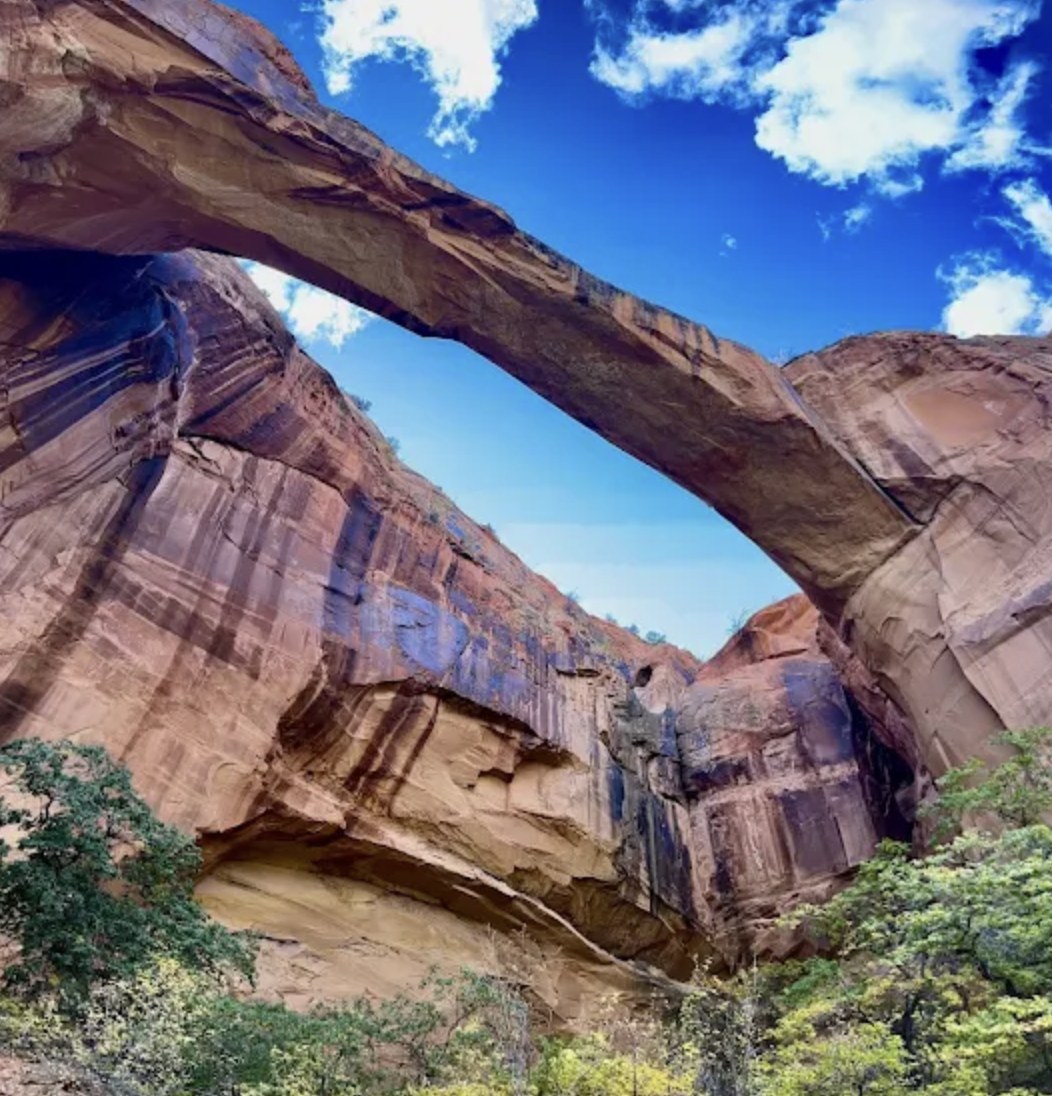
The side roads are the hard part
What each spur actually needs
The main road is rarely what stops people. The spurs are, because they are narrower, sandier and steeper, and because a low clearance car that made it 26 miles quite happily can ground out in the first half mile of a turnoff.
| Spur | Vehicle | Where it gets difficult |
|---|---|---|
| Dry Fork | Low clearance usually fine in good weather | The last stretch to the upper lot. Park at the first parking area and walk if in doubt. |
| Red Well | Usually fine for low clearance | Softens after rain. |
| Harris Wash | Generally passable by car | The wash crossings, which are a problem after rain rather than in general. |
| Egypt | Not recommended for low clearance | The Twenty-Five Mile Wash crossing two miles in, impassable after rain. Rocky and steep at about six miles. |
| Early Weed Bench | High clearance | The first two miles are the roughest. |
| Fortymile Ridge | Mixed | First four miles fine for low clearance. The last three need four wheel drive because of deep sand. |
Deep sand deserves its own warning because it behaves nothing like mud. Momentum is what gets you through it, stopping is what traps you, and the instinct to slow down is exactly wrong. If you are not confident in sand, park and walk. Nobody has ever regretted the extra mile on foot as much as they regretted the recovery bill.
If none of this appeals, that is a perfectly reasonable conclusion and there is a straightforward alternative. A guided trip or a shuttle puts the road problem onto somebody whose vehicle is built for it. See authorised local operators.
Before you drive
Where to check the road, properly
The best source is the Escalante Interagency Visitor Center at 755 West Main Street in Escalante, staffed jointly by BLM, the Park Service and the Forest Service. They publish a weekly road report and update it as conditions change, and the people behind the counter have usually spoken to somebody who drove it that morning. Open Tuesday to Saturday, 9am to 4pm, on 435-826-5499, with no admission charge.
Also check your rental agreement. A number of hire companies prohibit unpaved roads outright, which does not stop the car physically but does change who pays when something goes wrong. The getting here page covers the drive in and the nearest airports. Official route detail is on the NPS description of the drive and the visitor center page.
Staying out there
Dispersed camping along the road
Dispersed camping is allowed at pullouts and on side roads along Hole-in-the-Rock Road, and it is one of the better free camping experiences in Utah, mostly because of what happens overhead once the light goes. There are no facilities of any kind and you pack out everything, including waste.
Do
Camp on ground that is already bare and disturbed, in existing pullouts. The living soil crust between the pullouts takes decades to recover from a single set of tyre tracks.
Do not
Drive off the established surface to make a new spot, or leave waste behind. Human waste is a stated problem at the Dry Fork trailhead in particular.
Free permits are required for overnight stays within the national monument, and the boundary moved substantially in September 2026, so which rules apply where has genuinely changed. We cover this on the permits page and explain the change itself on the boundary page. Developed alternatives are on Escalante camping.
Questions we actually get
Frequently asked
Can I drive Hole-in-the-Rock Road in a rental car?
In dry conditions, yes for the first 26 miles or so, which covers Devils Garden and the Dry Fork trailhead. Drive slowly and expect heavy washboard. Beyond about mile 36 you want high clearance, and from roughly mile 46 the Park Service recommends four wheel drive. Check your rental agreement, because many prohibit unpaved roads.
How long does it take to drive to the Dry Fork trailhead?
Budget an hour each way from Escalante for the 26 miles plus the 1.7 mile spur, and more if the washboard is bad or you stop. People routinely plan on 40 minutes and are still driving an hour later, which is how hikes end up starting in the heat of the day.
What happens if it rains while I am out there?
Get back to the pavement as soon as you sensibly can. The clay surface becomes slick quickly and four wheel drive does not fix it. Wash crossings on the far half of the road can become impassable. If you are already stuck, you have no phone signal, which is why telling somebody your plan matters.
Is there fuel, water or a toilet on the road?
No fuel and no water anywhere. The only toilets are at Devils Garden, about 12 to 13 miles in. Fill up in Escalante and carry more water than you think you need, for the car as well as yourself.
Do I need a permit to drive it or park at a trailhead?
No. There is no fee to drive the road and no day use permit at the trailheads, including Dry Fork. Overnight camping within the national monument requires a free permit, and the monument boundary changed in September 2026, so check which side of the line your campsite falls on.
Can I drive all the way to Hole-in-the-Rock?
Only with four wheel drive and patience. The last stretch past Davis Gulch is rough and slow, and the Park Service suggests the final miles are better done on foot, by bike or in a four wheel drive. Most visitors never go past mile 36.
Decide what is at the end of the drive
The road is a means to something. Work out which canyon you are going for, or let somebody else do the driving.
Planning the wider trip? Start at the planning hub or read the town guide.
Road conditions change daily. The visitor center is on 435-826-5499.
Let a guide drive